Community rehabilitation of Lake Lahit in South Cotabato, Philippines
Share
Abstract
Lake Lahit, situated at the north central part of the Municipality of Lake Sebu in South Cotabato, Philippines, is the smallest lake among the three lakes of Lake Sebu. It has an area of 24 ha. It is the center of livelihood of the residents through operation of fish cages; source of water for irrigation and domestic purposes; sources of food; and for recreation and tourism. However, due to the proliferation of water lilies in the lake, fish production decreased and its tourism potential was lost.
For years, Lake Lahit was considered dead until the creation of the Lake Sebu Rehabilitation, Conservation and Development Council. The Department of Environment and Natural Resources (DENR) was one of the members of this multi-sectoral body, which formulated the program for the rehabilitation of the lake. The Provincial Government of South Cotabato, under the leadership of Governor Daisy P. Avance-Fuentes, provided initial funding of P1.2 million for the program. The Council created an Interim Team, headed by the Provincial Agriculture Office, which supervised the rehabilitation of Lake Lahit. A Task Force, Water Hyacinth for Barangay Lahit , was also formed which implemented the rehabilitation activities, including establishment of buffer zone, erosion control, community organizing, monitoring, and evaluation.
The clean-up of Lake Lahit was completed in a month, with the following activities undertaken prior to the clean-up: coordination with public officials; environmental scanning; rapid rural appraisal; strategic planning attended by all public officials from the Municipality of Lake Sebu and other government offices, farmer leaders, fish cage operators, resort owners, and non-government organization (NGO) representatives; and information, education and communication (IEC) through radio programs.
After the clean-up activities, the following activities were done: lakeshore reforestation through planting of mahogany seedlings, dispersal of 100,000 tilapia fingerlings, and issuance of an Executive Order prohibiting the catching of tilapia and other species in the lake five months after dispersal. The Barangay Lake Lahit Council a resolution of cleaning the lake by the local communities.
Through this program, the local communities appreciated the environmental and economic importance of the Lake and became actively involved in its protection. Cooperation and coordination were established among the different entities with direct stake on the lake.
Suggested Citation
Sequito, G. L. (2005). Community rehabilitation of Lake Lahit in South Cotabato, Philippines. In M. L. Cuvin-Aralar, R. S. Punongbayan, A. Santos-Borja, L. V. Castillo, E. V. Manalili, & M. M. Mendoza (Eds.), Proceedings of the First National Congress on Philippine Lakes (pp. 288-291). Southeast Asian Regional Center for Graduate Study and Research in Agriculture (SEARCA).
Type
Conference paperISSN
1656-8099Collections
- LakeCon2003 [49]
Related items
Showing items related by title, author, creator and subject.
-
Series: Summary of Proceedings No. 1/2013;
Save Lake Buhi now
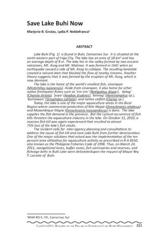
(PCAARRD-DOST, 2013)Lake Buhi (Fig. 1) is found in Buhi, Camarines Sur. It is situated at the north-eastern part of Iriga City. The lake has an area of 18 km2 and has an average depth of 8 m. The lake lies in the valley formed by two ancient volcanoes, Mt. Asog and Mt. Malinao. It was formed in 1641 when an earthquake caused a side of Mt. Asog to collapse. The resulting landslide created a natural dam that blocked the flow of nearby streams. Another theory suggests that it was formed by the eruption of Mt. Asog, which is now dormant. The lake is the home of the world s smallest fish, sinarapan (Mistichthys luzonensis). Aside from sinarapan, it also home for other native freshwater fishes such as 'irin-irin' (Redigobius dispar), 'dalag' (Channa striata), 'puyo' (Anabas studines), 'kotnag' (Hemiramphus sp.), 'burirawan' (Strophidon sathete), and native catfish (Clarias sp.). Today, the lake is one of the major aquaculture areas in the Bicol Region where commercial production of Nile tilapia (Oreochromis niloticus) and Mozambique tilapia (Oreochromis mossambicus) is done. The lake supplies the fish demand in the province. But the cyclical occurrence of fish kills threaten the aquaculture industry in the lake. On October 31, 2010, a massive fish kill was again experienced that resulted to almost 75% loss of the lake s fish stocks. The incident calls for inter-agency planning and consultations to address the cause of fish kill and save Lake Buhi from further deterioration. One of the major solutions that arised was the implementation of the ten percent area utilization for aquaculture activity as prescribed in R.A 8550, also known as the Philippine Fisheries Code of 1998. Thus, on March 24, 2011, navigational lanes, buffer zones, fish sanctuaries and reserves, and fishcage belts in Buhi Lake were delineatedupon the request of Mayor Rey P. Lacoste of Buhi. -
Integrated water resources management: the experience of Laguna Lake Development Authority (LLDA), Philippines
(Southeast Asian Regional Center for Graduate Study and Research in Agriculture (SEARCA), 2005)Laguna de Bay is the largest inland body of water in the Philippines and one of the largest lakes in Southeast Asia. The lake and its watershed, technically referred to as the Laguna de Bay Region or Basin, encompasses the provinces of Rizal and Laguna, portions of Cavite, Batangas and Quezon and a large portion of Metro Manila. It is a host to a total of 66 local government units (LGUs) (49 municipalities, 12 cities and five provinces) and is home to over 10 million people. Over recent decades, uncontrolled population growth, indiscriminate deforestation and land conversion, intense fisheries, widespread industrialization, and urban sprawl have produced massive changes in the Laguna de Bay and its watershed. The resulting problems relate to solid waste management, sanitation and public health, congestion, sedimentation, unmitigated input of domestic, agricultural and industrial wastes, deteriorating water quality, flooding problems, and loss of biodiversity. The task of turning the tide of environmental degradation and of protecting and conserving the lake and its watershed for posterity calls immediate and decisive action. Using the so-called Integrated or Basin Approach to water resources management, the Laguna Lake Development Authority (LLDA) has initiated a number of innovative actions that could spell the difference in the effort to save Laguna de Bay. These include: a) the Environmental User Fee System (EUF), a market-based instrument designed to motivate polluters to comply with effluent standards; b) Zoning and Management Plan (ZOMAP) for fish pens and fish cages; c) Shore Land Development and Management Plan (SMDP); and d) the River Rehabilitation Program. The module for River Rehabilitation developed over seven years has produced a model for multistakeholder and community participation and involvement in the task of resource conservation and management which is gaining recognition internationally. -
State of Philippine coastal fisheries
(Aquaculture Department, Southeast Asian Fisheries Development Center, 1998)